Workshop Data in MSP
Workshop ‘Data in MSP’
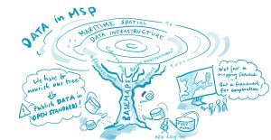
Why do we need decentralized MSP data access?
Close your eyes. Imagine you are an MSP planner and are working on a plan. You need to search reliable and up-to-date data from your own country. That is important but you need something else: up-to-date data from your neighboring countries. That is the hardest part.
You could use some centralized databases to access regional data aggregations but these systems do not necessarily guarantee that the datasets are up to date. To make sure you have the latest data, you would need to access the original source but where do you search?
In Baltic LINes we have taken the first steps to solve this problem.
We have developed the first map service prototype to access Baltic MSP up-to-date data from the original source. It is based on a Marine Spatial Data Infrastructure (MSDI) utilizing decentralized data hosting and we call it BASEMAPS (BAltic SEa MAP Service).
In this workshop you will:
- Learn from the example of the German and Norwegian SDI to catalogue and distribute national data.
- Learn why and how we developed BASEMAPS, to access MSP data from their original source.
- The best comes here: You will contribute to make MSP data better available by participating in a practical exercise testing the system.
- If you are a MSP planner, GIS specialist, a data provider or belong to an authority that need data to work with MSP this session is for you.
Presentations and speakers
Download by clicking on a presentation title
- Getting up-to-date and reliable regional MSP data, dream or reality? Manuel Frias, HELCOM Secretariat; Dr. Henning Sten Hansen, Aalborg University. National data services in Germany. Olaf Gottenstraeter, German Federal Maritime and Hydrographic Agency (BSH)
- Marine Spatial Management Tool. Gerhard Heggebø, Norwegian Mapping Authority


